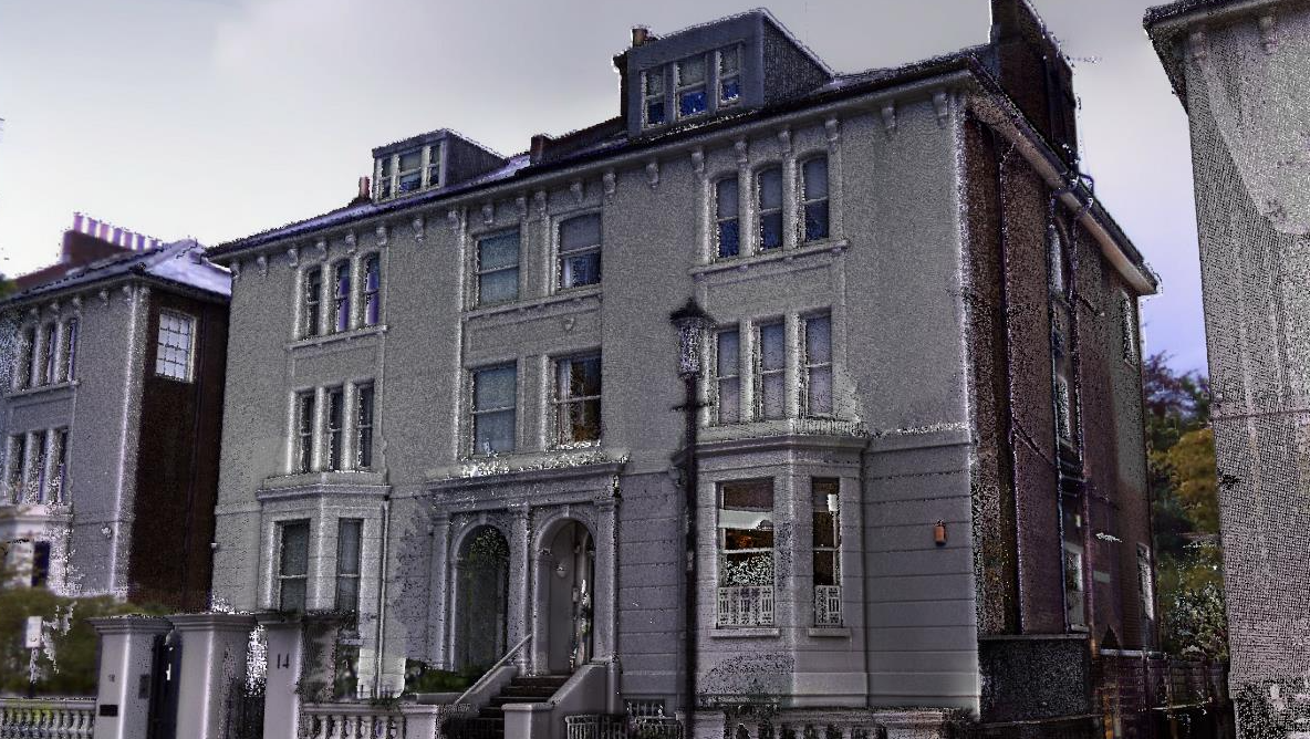
SCAN TO REVIT

Scan-to-Revit

3D models based on As-Built condition

Accurate and accessible Revit modelling

We offer a Scan-to-Revit  service. Starting from a 3D laser scanning survey of a physical space we will create an accurate, digital representation of the space in Revit software using a 3D scanned point cloud as a background reference for modelling.


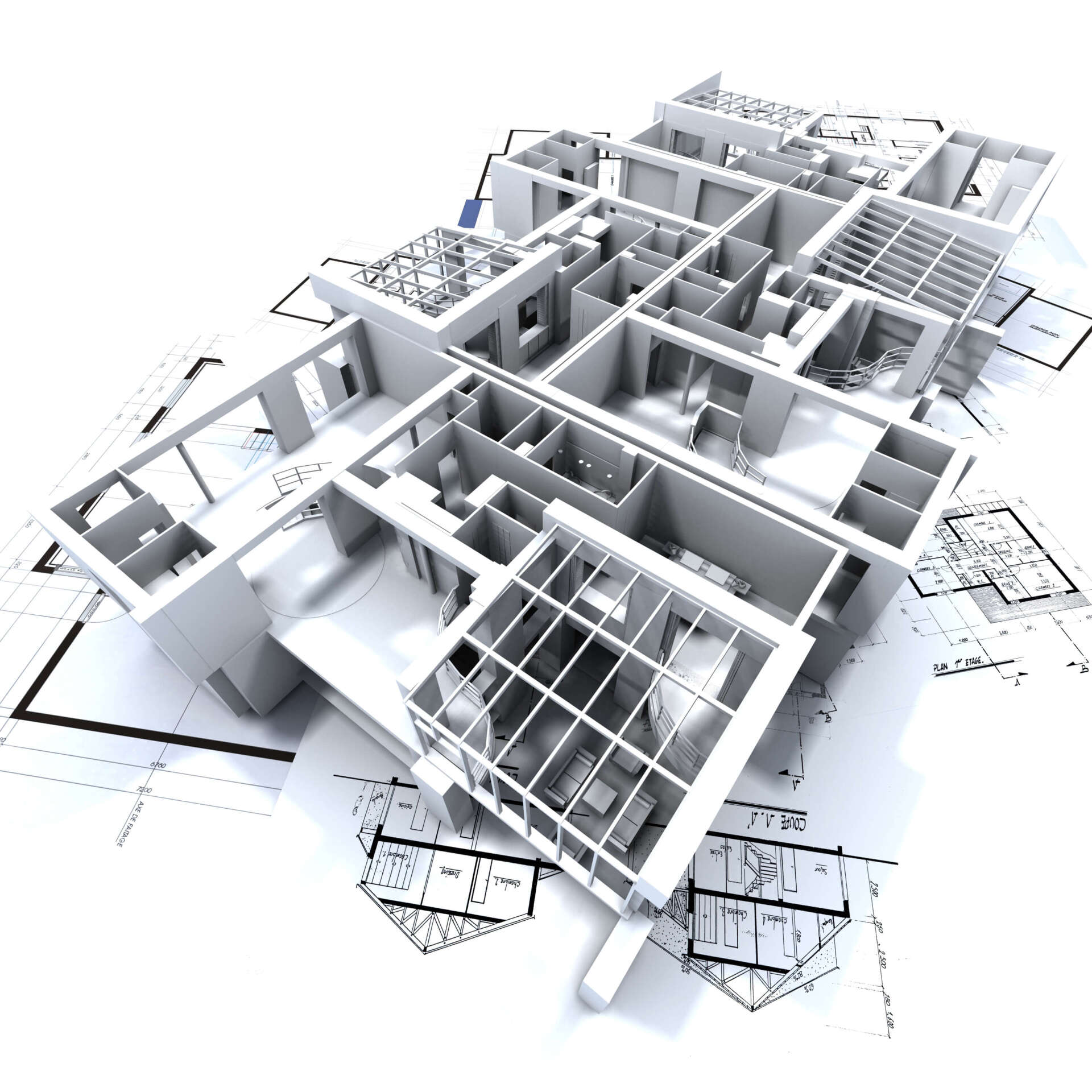
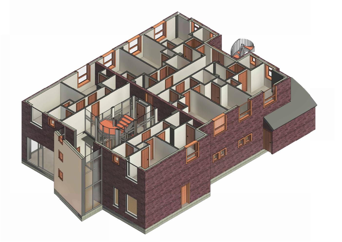
Depending on project requirements we offer the following Level of detail (LOD):

  • LOD 100 - Mass Model 
  • LOD 200 - Basic model
  • LOD 300 - Standard Survey Model

You will receive an accurate Revit model as well as a point cloud file.


MORE ABOUT SCAN TO REVIT

BES Team

Our team is made up of experienced construction engineers who have worked on a broad spectrum of projects. We’re based in London, but are available to work on projects across the UK.

3D Laser Scanner

At BES we use the latest technology and software to capture data. This allows us to provide highly accurate surveys for our clients, minimising planning errors.

Professional bespoke service

Our construction experience allows us to provide a bespoke service that’s tailored your project requirements.

Services designed to meet industry demands

3D models based on As-Built condition allows architects, engineers, and construction specialists to design and plan work with confidence

ARRANGE A SURVEY NOW

Useful Articles

by Gregorio Bruno 05 Jun, 2023
Preserving our cultural heritage is crucial to understanding our past and shaping our future. Historical buildings, monuments, and landmarks are not just beautiful to look at, but they also serve as a reminder of our ancestors and their way of life. However, preserving these structures and landmarks is not an easy task. It requires a delicate balance of preserving the original structure while also ensuring it is safe and functional for future generations. This is where laser scanning survey technology comes in. Laser scanning survey is a non-invasive and highly accurate method for capturing the existing conditions of a structure or monument. By using laser scanning survey for heritage preservation, we can reap several benefits: Accurate Record of Heritage Structures Laser scanning survey allows us to create highly accurate 3D models of heritage structures, providing us with an invaluable record of their current state. This record can be used to assess the condition of the structure, identify areas that require repairs or restoration, and monitor the structure's stability over time. The detailed and accurate 3D models created from laser scanning survey can also serve as a reference for future preservation efforts. Preservation without Damage Preserving a heritage structure requires care and caution to avoid damaging the building's original features. Laser scanning survey is a non-invasive technique that doesn't require any physical contact with the structure, making it ideal for heritage preservation. It captures precise data without causing any damage to the structure, allowing for accurate measurements to be taken without harming the building. Efficient Preservation Planning Laser scanning survey provides detailed information about the structure's existing conditions, allowing preservation teams to plan and execute their work more efficiently. The data obtained from laser scanning survey can be used to create accurate floor plans, elevation drawings, and sections, enabling preservation teams to assess the condition of the structure and identify any areas that require repairs or restoration. This information can also be used to plan the logistics of the preservation effort, such as the placement of scaffolding and access points.  In conclusion, laser scanning survey technology plays a vital role in heritage preservation. By providing accurate and detailed information about heritage structures, laser scanning survey allows preservation teams to plan their work more efficiently, preserve the original structure without damage, and even facilitate the restoration or reconstruction of damaged or destroyed structures. At BESurvey, we are committed to providing the highest quality laser scanning survey services for heritage preservation projects in London and the UK.
by Gregorio Bruno 29 May, 2023
Building Information Modeling (BIM) is a process that involves the creation of a digital model of a building, which can be used throughout the entire lifecycle of a construction project. It is a collaborative and data-driven approach that is rapidly gaining popularity in the construction industry. One of the key technologies that play an important role in BIM workflows is laser scanning survey.  Laser Scanning Survey: An Overview Laser scanning survey involves the use of a laser scanner to capture accurate and detailed data about a building's physical features. The scanner emits laser beams that bounce back from the surfaces of the building and are captured by a sensor. The captured data is then processed to create a 3D point cloud, which can be used to generate a highly accurate digital model of the building. The Role of Laser Scanning Survey in BIM Workflows Laser scanning survey plays a critical role in BIM workflows. It enables architects, engineers, and construction professionals to create highly accurate digital models of existing buildings. These models can be used for a variety of purposes, such as renovation and retrofitting projects, as-built documentation, and clash detection. As-Built Documentation Laser scanning survey is particularly useful for creating as-built documentation, which involves capturing accurate data about the physical features of a building that has already been constructed. As-built documentation is essential for renovation and retrofitting projects, as it provides accurate information about the existing conditions of a building. This information can be used to ensure that the proposed changes are feasible and can be implemented without any issues. Clash Detection Clash detection is another important application of laser scanning survey in BIM workflows. Clash detection involves identifying potential clashes or conflicts between different building systems, such as electrical, plumbing, and HVAC systems. By using laser scanning survey to create a highly accurate digital model of the building, construction professionals can identify these clashes before construction begins, which helps to prevent costly delays and rework. Conclusion Laser scanning survey is a key technology that plays an important role in BIM workflows. It enables architects, engineers, and construction professionals to create highly accurate digital models of existing buildings, which can be used for a variety of purposes. Whether it is for as-built documentation, clash detection, or any other application, laser scanning survey helps to enhance the accuracy and efficiency of BIM workflows. At BESurvey, we offer laser scanning survey and a range of other surveying services in London and the UK. Contact us today to learn more about how we can help you with your BIM workflows.
by Gregorio Bruno 15 May, 2023
Improving Accuracy, Efficiency, and Cost Savings in 3D Modeling with Laser Scanning Survey Laser scanning survey is a powerful tool that provides an accurate and efficient method for 3D modeling. With laser scanning, surveyors can quickly and accurately measure the built environment, producing precise and detailed 3D models for use in a variety of applications. One of the main advantages of using laser scanning survey for 3D modeling is the improved accuracy of the resulting models. Laser scanning can capture millions of data points in a matter of seconds, providing a level of detail and accuracy that is difficult to achieve with traditional surveying methods. This means that the resulting 3D models are highly accurate representations of the real world, enabling more precise design, analysis, and construction. In addition to improved accuracy, laser scanning survey also offers significant efficiency benefits. Because laser scanning can capture data so quickly and accurately, it reduces the time required for data collection and processing. This means that surveyors can complete projects more quickly, and designers can begin working on 3D models sooner. Laser scanning survey also offers cost savings by reducing the need for rework and field visits. Because the resulting 3D models are so accurate, they can be used for a variety of purposes, including clash detection and construction planning. This reduces the likelihood of errors or conflicts arising during construction, which can lead to costly rework and delays. Furthermore, using laser scanning survey for 3D modeling can be particularly beneficial in complex environments, such as heritage buildings or industrial facilities. Traditional surveying methods can be time-consuming and difficult to execute in these environments, but laser scanning can quickly capture data from even the most challenging spaces. This allows for accurate and detailed 3D models to be created, even in complex and challenging environments.  At BESurvey, we provide laser scanning survey services for clients across London and the UK. Our experienced team of surveyors use the latest technology and techniques to capture highly accurate and detailed data, enabling us to produce precise and detailed 3D models for a range of applications. From measured surveys to scan to BIM services, we have the expertise to deliver projects of all sizes and complexities. Contact us today to learn more about how laser scanning survey can benefit your next 3D modeling project.
Show More

Bruno Engineering Ltd

33 Connaught Gardens, Morden, London

07557 132 697

info@besurvey.co.uk 


© 2022. The content on this website is owned by us and our licensors. Do not copy any content (including images) without our consent. Privacy Policy | Terms and conditions

Share by: