Point Clouds for Building Analysis
Utilizing Point Clouds directly for analysis
If required, BES can provide a 'point cloud only' service, and this can be used to work directly with almost all common design software packages such as Autocad, Revit, Tekla etc.
By working with the cloud, you are in control of what you want to see in the project.
With the point cloud, is it possible to:
- Start design process using PC as base. (example of steel designer)
- Verify as-built information
- Analyse structural walls verticality and deformation
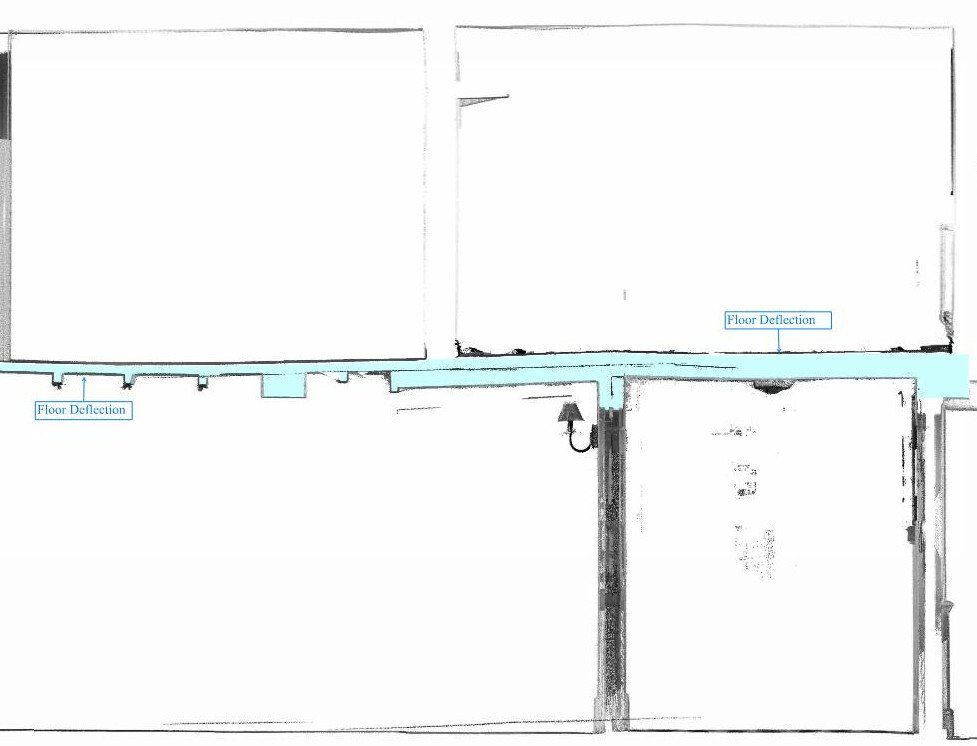
- Analyse floor and ceiling deformation and irregularity
- Check the surroundings to understand site conditions
- Visualize and measure complex geometrical objects such as curved ramps, parabolic columns, etc.
Working with a point cloud in a retrofit design project will allow you to visualize the whole structure and identify irregularities which cannot be spotted by a site visit or a traditional survey.
BES can also classify the point cloud and create layers to isolate necessary and unnecessary elements to help you visualize and work only with the required data.


Building Analysis Made Easy
We use our specialized software to investigate floor flatness or wall verticality but a simpler solution is to spot potential issues before they arise. You can do that simply by using a commonly used software design and identifying potential building problems before they become an issue.
Geo-located Point Clouds
By using Control Points, we can correctly geo-reference projects to link registered scans to a project coordinate system
PC Analysis
Visualize the whole structure and identify irregularities which cannot be spotted by a site visit or a traditional survey
Mechanical Electrical Plumbing (MEP)
The scanned data provides information on the current situation and insight into possibilities for expansion.
Highly accurate 3D laser scanner
Our team uses a high-speed survey-grade 3D laser scanning system which has up to 2mm accuracy and is effective on dark and reflective surfaces undetectable by most other scanners. Depending on project requirements captured point density can be adjusted to meet specification.
Bruno Engineering Ltd
33 Connaught Gardens, Morden, London

© 2022. The content on this website is owned by us and our licensors. Do not copy any content (including images) without our consent. Privacy Policy | Terms and conditions