3D Point Cloud Survey
Point cloud revolutionized survey techniques using lasers to scan in 3D.
The results are a highly detailed plan, reducing the need for rework and increasing confidence in the data.
3D Point cloud survey
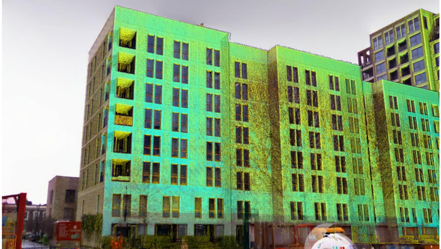
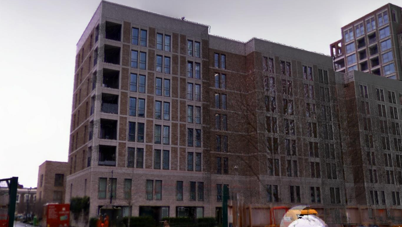
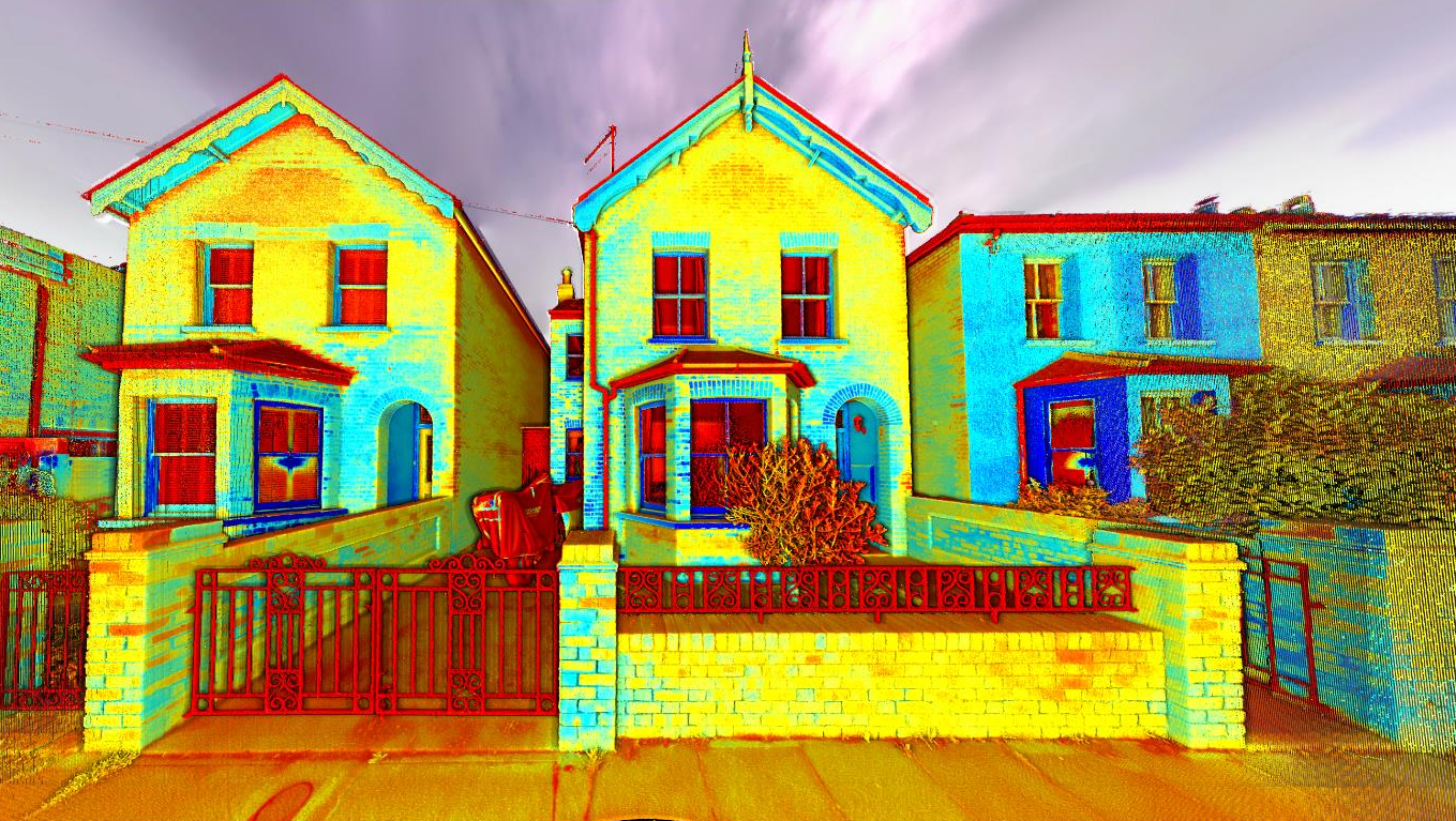
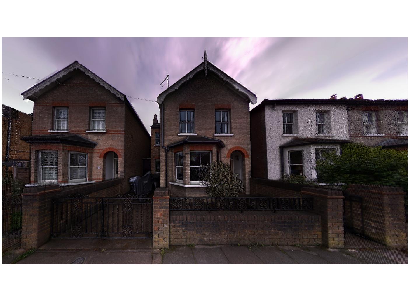
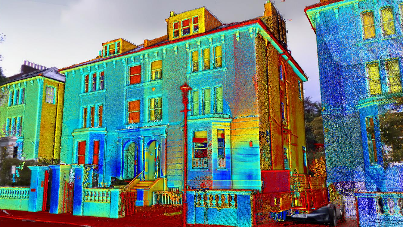
Point clouds are a digital representation of real objects/spaces displayed as a set of data points in space. They are obtained using specialist surveying equipment which completes and ties together a set of 360 degree scans to 2mm accuracy.
They can be produced for any kind of physical spaces such as buildings, outside areas, roads, etc.
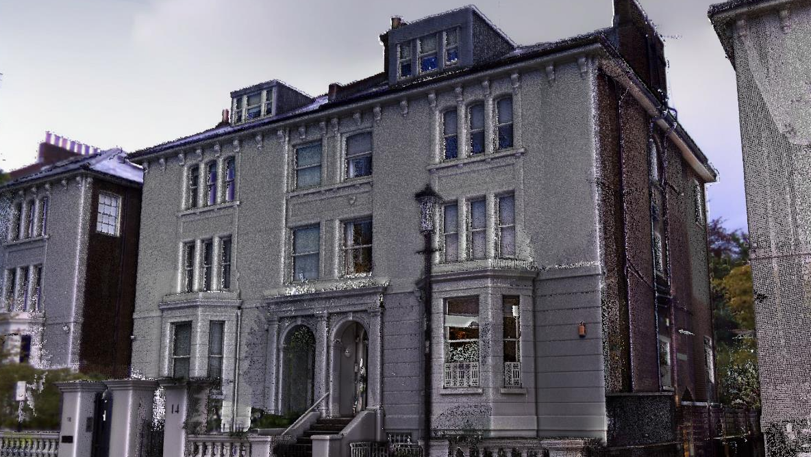
Point cloud can be colourized to define and display material and georeferenced so each point has a true coordinate and level.
It is also possible to clean and classify the cloud from unwanted "noise" data such as furniture and trees to only show the desired object/s.
Point Clouds in the Design Process
One thing that can help speed up the process and reduce overall costs especially for small or medium projects is working directly with point clouds. A point cloud is a set of data points in three-dimensional space that can used into AutoCad, Revit, Archicad or other design softwares to produce construction documentation.
Geo-located Point Clouds
By using Control Points, we can correctly geo-reference projects to link registered scans to a project coordinate system
PC Analysis
Visualize the whole structure and identify irregularities which cannot be spotted by a site visit or a traditional survey
Mechanical Electrical Plumbing (MEP)
The scanned data provides information on the current situation and insight into possibilities for expansion.
Highly accurate 3D laser scanner
Our team uses a high-speed survey-grade 3D laser scanning system which has up to 2mm accuracy and is effective on dark and reflective surfaces undetectable by most other scanners. Depending on project requirements captured point density can be adjusted to meet specification.
Bruno Engineering Ltd
33 Connaught Gardens, Morden, London

© 2022. The content on this website is owned by us and our licensors. Do not copy any content (including images) without our consent. Privacy Policy | Terms and conditions