2D As-Built Measured Surveys
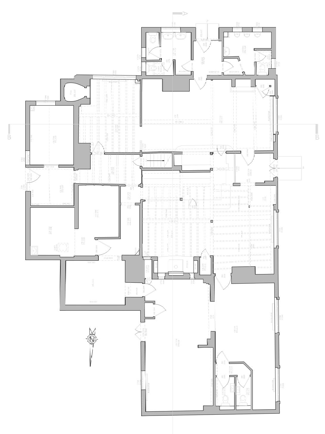
Producing 2D As-Built Surveys
Where a 2D As-built survey is required of a physical space, the area can be scanned to obtain a 3D point cloud. The information from the point cloud can then be used to produce 2D As-built drawings quickly and accurately with AutoCad.
This system eliminates the need to re-visit site for additional or missing information as everything is already stored in the point cloud, and can be easily accessed with Cad, Revit, Tekla and other common design software.
BES provide point cloud and/or 2D drawings of
any physical space based on the cloud survey.
The drawing's level of detail can be chosen after the
scanned survey has been completed depending on
project needs, as the cloud will represent the
entirety of the survey space.
The cloud can also be navigated using free
viewers allowing users to access scanned
panoramic images, take pictures of the space and
take measurements directly.


Free Viewer
As a secondary product after each scan survey, BES can provide a free viewer that allows you to navigate through the scanned environment using panoramic images. Using this viewer, the user can then take measurements, extract photos and add annotation as required.
With this tool you can remotely view site conditions and "walk through" the working area from your office, increasing working efficiencies and visibility.


Geo-located Point Clouds
By using Control Points, we can correctly geo-reference projects to link registered scans to a project coordinate system
PC Analysis
Visualize the whole structure and identify irregularities which cannot be spotted by a site visit or a traditional survey
Mechanical Electrical Plumbing (MEP)
The scanned data provides information on the current situation and insight into possibilities for expansion.
Highly accurate 3D laser scanner
Our team uses a high-speed survey-grade 3D laser scanning system which has up to 2mm accuracy and is effective on dark and reflective surfaces undetectable by most other scanners. Depending on project requirements captured point density can be adjusted to meet specification.
Bruno Engineering Ltd
33 Connaught Gardens, Morden, London

© 2022. The content on this website is owned by us and our licensors. Do not copy any content (including images) without our consent. Privacy Policy | Terms and conditions